-
36-hr ICR bandh marred by sporadic violence, Sub inspector…
-
Governor condoles demise of Bengia Tolum
-
Arunachal Pradesh to undertake Special Intensive Revision of …
-
Large acreage of wild cannabis destroyed in joint…
-
New community hub 'Ekta Bhawan' opens at Yazali Police…
-
Dr. Joram Aniya calls on Governor
-
Indian Army inaugurates transit facility at Sigar Military Station
-
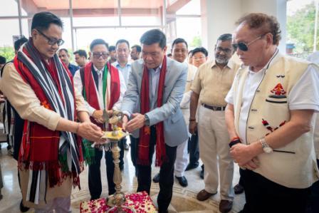 Khandu inaugurates Arunachal Niwas, fourth facility in New Delhi
-
ACS announces sit-in protest, demands CM’s resignation on moral grounds
-
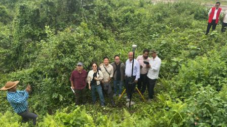 Assam-Arunachal border delineation exercise concludes in Lower Siang
Panchayati Raj system has been in existence since long in India and always been hailed as a classic example of decentralization of governance for achieving sustainable development of villages. During last decade it has got a shot in the arm with the aid of technologies which has made it more robust and people-friendly. Geographical Information System or GIS is one such and the recent state level training-cum-workshop on GIS Based Gram Panchayat Planning under MGNREGA was of vital importance since it is actually the homework process for implementation of this great technological aid in socio-economic upliftment of the state’s villages.
GIS, which is basically the science of obtaining information from a distance is ushering in solid changes in economic, social and scientific endeavours of nations all over world. For India, a country vast in every sense in terms of area, population and evolving economic challenges, it is really a great gift of modern science to count on, in quest of inclusive growth, social equity and development. It is little wonder why GIS has been given such huge importance by policy makers of the country and viewed as not just essential but an urgent necessity. Time and again it had proved that it can be an indisputable tool for bringing inclusive economic growth, expedite development and reduce disparity among common people who are the actual intended beneficiaries.
It is often repeated that India lives in villages and it wouldn’t also be wrong to remark that most of the nation’s woes have their severe manifestations in villages. Gram Panchayats are the lowest units of rural local self-government system and their importance in rural India hardly needs any elaboration as they are in actual touch with the rural masses and understands the ground realities far better than most of the administrative hierarchies. To make the institution of Panchayati Raj stronger, it has been planned to incorporate GIS comprehensively in all states. The basic data which form a part and parcel of any rural development planning regarding infrastructure of roads, drinking water resources, schools, household information, housing structure, type of material used in house construction, basic amenities like electricity, water, telephone , house & water taxes etc will now be more efficiently gathered via GIS, thus ushering in transparency and efficiency.
GIS can be of great assist to Arunachal not only for MGNREGA alone but also in its overall rural developmental strategies keeping in mind the landlocked nature of its topography and long history of below average development.
It’s an appreciable and extraordinary tool and full use of it will ensure materialization of Arunachal’s rural aspirational goals within the set out time frames.

Kenter Joya Riba
(Managing Editor)She is a graduate in Science with post graduation in Sociology from University of Pune. She has been in the media industry for nearly a decade. Before turning to print business, she has been associated with radio and television.
Email: kenterjoyaz@easternsentinel.in / editoreasternsentinel@gmail.com
Phone: 0360-2212313