-
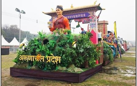 Arunachal tableau on R-Day spotlights state’s emergence as Adventure Capital…
-
Etalin marks National Voters’ Day, encourages youth participation in democracy
-
Sona reviews PMGSY, VVP projects in Itanagar Circle
-
Lok Bhavan celebrates UP Diwas
-
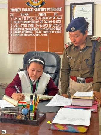 KGBV student leads WPS Pasighat on National Girl Child Day
-
Meritorious students felicitated on National Girl Child Day
-
Awareness on POCSO held as part of National Girl Child…
-
Anini certifies 79 Nature Guides on National Tourism Day
-
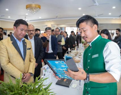 Startup success stories reflect potential of state’s youth: CM
-
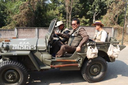 Mein participates in vintage Willys Jeep Rally, inaugurates World War…
Arunachal East MP Tapir Gao during zero hour in LS on Wednesday has drawn attention of the central government regarding certain discrepancies present in the political map of the country which is through and through related to Arunachal Pradesh. Trying to drive home the point that certain portions of the state are missing from the current national political map, he has been categorical by pin-pointing the particular places which are by nature bona fide territories of the Indian Union, but somehow being left out so long due to some cartographical lacunae. Even if only a detailed technical assessment by survey experts will be the ultimate solution to the issue, it must be said that it is necessary to treat the matter with great seriousness, exclusively due to the fact that there is always a prospective ‘land poacher’ which is unmistakably China and if a technical error gives them elbow room which might end up as territorial loss, it will be most unfortunate. The larger intention of raising the issue is presumably this and since it concerns national interest, there must be an immediate attention.
The MP has called for certain specific actions such as inclusion of the ‘missing’ Angie Valley of Anini along with Drai Valley, Kajab and Kayo Valleys of Chaglagam area in Anjaw district in Arunachal’s political map. He also added that border outposts of Hadigra Dakahru Pass, Galai Tagaru Pass and Tatu Pass which remain constantly guarded by Indian Army and ITBP jawans are outside the national map and all these had happened due to faulty Atlas drawing which dates back to the British regime. Accepting the possibility that there might be some technical limitations during those days which can lead to this misrepresentation, the current advanced level of surveys are more than enough to find out the ground zero picture. And sooner it is done the better, since China might not waste time to make it an issue and more because to avoid an another Doklam-like standoff whose roots lie in territorial claims and counterclaims. It’s also well known that Arunachal is a dream for China which it expresses officially claimn upon as an ‘integral territory’ named South Tibet through political maps and a technical indistinctness of the Arunachal political map might even give air to their ‘claim’ on international fora. It’s nothing unexpected from a country which even objects India’s President’s, Prime Minister’s or the Defence Minister’s visit to the state.
Keeping in view of the complexities that have fair chances to arise in near future, it will be rational to act sharp by digging out real facts and make necessary cartographical alterations, if any, to check a national territorial dilution.

Kenter Joya Riba
(Managing Editor)She is a graduate in Science with post graduation in Sociology from University of Pune. She has been in the media industry for nearly a decade. Before turning to print business, she has been associated with radio and television.
Email: kenterjoyaz@easternsentinel.in / editoreasternsentinel@gmail.com
Phone: 0360-2212313