-
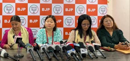 BJP Arunachal condemns Opposition for blocking Women’s Reservation Bill
-
Mein attends foundation laying ceremony of international meditation center &…
-
 CM Khandu attends grand finale of Arunachal Runway
-
Galo community holds candlelight march over lack of arrests in…
-
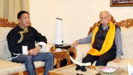 CM calls on Governor, discusses state’s dev issues
-
Teachers’ body to hold candlelight vigil for slain teacher
-
.jpg) Governor visits Border Outpost, interacts with Army troops
Governor visits Border Outpost, interacts with Army troops
-
Chief Justice, Gauhati High Court launches “APSLSA Documentaries”
-
Corps commander calls on Governor
-
Mebo MLA stresses on impactful dev & innovation approach
.jpg)
ES Newsdesk
ITANAGAR, Nov 23: Nearly a month since the Kameng River turned turbid on October 29 last leading to large scale death of fish, a clear picture seems to be emerging as to what might have triggered the event.
Finally clear views of Ngyarisatam’s mountain slope and the Wapra Bung glacier shows us the real extent of the deposits. Satellite images taken on November 3, 17 and 18 show a fairly dynamic snow cover, freeze-thaw process ongoing. The images also show that the most unstable part of the Ngyarisatam’s mountain slope is still sliding, giving off dust plumes.
Comparison of images shows some surge event between November 2020 and October 2021. Also shown is the dynamic environment of freeze, thaw and snow accumulation cycles in the area. Once the fresh snow melts the glaciers reveal their black colour. These vast black lobes is not just glacial debris or moraines but is the glacier itself confirmed from photographs taken at multiple glaciers in this area by mountaineer Tapi Mra, who has worked here for 10 years.
The best possible explanation for why these glaciers are black is because the bed rock here is shale or slate from the Tethyan Himalaya zone. This is also the cause for the Kameng river to be dark grey in colour. Why the entire glacier is a mix of black silt and ice is yet to be ascertained, says independent researcher and geographer Chintan Sheth who has been studying the event since day one and currently stationed at Seppa.
Sheth adds that based on latest satellite images the expanse of the debris flow was 1.5km at the widest in the glaciated valley. Some moraines with vegetation have been covered in debris deposits when compared with the November 18th image with the October 1st image. The debris flow then narrowed into a gorge 600m wide before opening up into the valley. The maximum height up to which debris was deposited is as much as about 124m in this narrow portion of the gorge shown in the November 18th image.
“Local Puroik tribals that witnessed the first event saw a block of ice and rock break off Ngyarisatam on the Kameng river side but not on the Wapra Bung river side. They did not observe any debris flow or flood on the Kameng river side on the west of Ngyarisatam but saw the debris flow slowly through the valley accumulating mud, trees, boulders along the Wapra Bung river valley. They managed to cross the river by felling a tree because their bridge was taken out. When they returned the next time this makeshift log bridge too was taken away. This was likely because of the second debris flood event that took place before November 4 last. No other animals were found dead other than fish,” Sheth adds who is closely working with the East Kameng administration and locals to study the event.

Kenter Joya Riba
(Managing Editor)She is a graduate in Science with post graduation in Sociology from University of Pune. She has been in the media industry for nearly a decade. Before turning to print business, she has been associated with radio and television.
Email: kenterjoyaz@easternsentinel.in / editoreasternsentinel@gmail.com
Phone: 0360-2212313