-
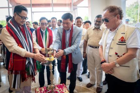 Khandu inaugurates Arunachal Niwas, fourth facility in New Delhi
-
ACS announces sit-in protest, demands CM’s resignation on moral grounds
-
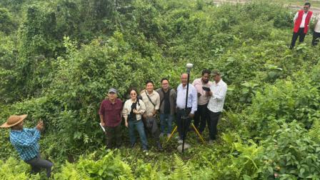 Assam-Arunachal border delineation exercise concludes in Lower Siang
-
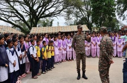 Indian Army commemorates first anniversary of Operation Sindoor
-
Fun, creativity mark VKV Alumni Summer Camp at Chimpu school
-
Power lines severely damaged in Khonsa
-
KV Khonsa shines at KVS Tinsukia Regional Sports Meet
-
 Khandu calls Arunachal “powerhouse of India” in hydropower generation
-
Itanagar Police arrests key interstate heroin supplier
-
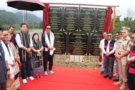 Mein inaugurates key infra projects under PMGSY-III
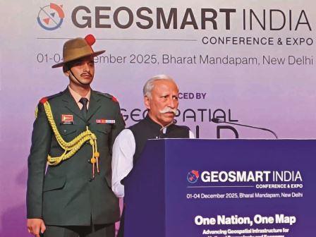
New Delhi, Dec 2: Arunachal Pradesh Governor Lt. General KT Parnaik (Retd.) participated in the GeoSmart India 2025 at Bharat Mandapam, New Delhi on Tuesday. The 4-day Conference cum Expo with the theme ‘One Nation, One Map’ Advancing Geospatial Infrastructure for National Sovereignty and Economy is being organised by Geospatial Media and Communications.
Participating in the North East Conclave section of the event, Parnaik said that geospatial technology, ranging from GIS and GPS to drones, satellite imagery, and digital maps has become an essential tool for smart, evidence-based governance. He said that it strengthens the developmental process by mapping terrain, resources, and infrastructure gaps with precision, enabling planners to choose the best locations for roads, bridges, and public services while reducing guesswork and ensuring alignment with community needs and environmental realities.
The Governor said that geospatial tools also make monitoring more transparent and efficient by tracking land use, forests, water bodies, crop patterns, and project progress in real time, allowing timely corrective action. These technologies, he added, support scientific assessment of natural resources, climate patterns, biodiversity, and socio-economic trends, helping policymakers make informed, future-ready decisions.
Parnaik said that before major projects begin, geospatial analysis helps evaluate feasibility, risks, and environmental sensitivity, reducing disputes and cost overruns. He suggested developing a State-level geospatial policy, building a central data repository, training government teams in GIS, using dashboards for public projects, integrating drone-based mapping, and fostering collaboration among departments to create unified geospatial datasets for better decision-making. The Governor said that geospatial technology will be a transformative force for Arunachal Pradesh, helping the State plan and grow wisely.
The Governor said that the geospatial technology tools are vital for disaster preparedness, allowing early identification of landslide zones, flood paths, and vulnerable settlements, and supporting quicker, more targeted response. Geospatial monitoring, he said, will strengthen environmental protection by tracking forests, wildlife corridors, and river systems, and will boost agriculture by identifying suitable zones for key crops like kiwi, orange, and apple and supporting precision farming. It will also improve both urban and rural development through better land records, drainage planning, and asset management; assist border management along remote frontiers; and help promote sustainable tourism through accurate mapping of trekking routes, cultural sites, and eco-tourism zones, he said.
The Governor emphasized that GIS dashboards will bring greater transparency to government projects, while mapping natural resources and renewable energy potential will guide long-term sustainability, making geospatial technology a critical foundation for the State’s future growth and good governance.
The Governor, who recently reviewed the implementation of PM GatiShakti in the State, said that while the GatiShakti platform is an invaluable tool for tracking the progress of welfare schemes and infrastructure projects, Arunachal Pradesh must now take a step further. He emphasized that with a State-specific AI application built around local needs and geographical realities, the government can develop an integrated, user-friendly dashboard accessible to all departments. Such a unified platform, he said, would not only streamline coordination and eliminate duplication of efforts but also ensure faster decision-making, greater transparency, and more responsive governance for the people of Arunachal Pradesh.
The Governor, while underscoring the urgency of developing a State-specific application, said that such an advanced platform would greatly strengthen Arunachal Pradesh’s security architecture. He explained that it could map and analyze drug-trafficking routes with far greater precision, support continuous border monitoring and surveillance in remote areas, and enable real-time fusion of intelligence from different agencies. By creating a common space for interagency collaboration, the system would make information-sharing quicker and more reliable, enhancing airspace monitoring, cross-border intelligence coordination, and the tracking of suspicious movements.
The Governor added that it would also assist in asset-tracking and seizure operations, empowering law-enforcement agencies to act swiftly and decisively, and ultimately helping protect the State’s youth, communities, and long borders with greater efficiency and confidence.

Kenter Joya Riba
(Managing Editor)She is a graduate in Science with post graduation in Sociology from University of Pune. She has been in the media industry for nearly a decade. Before turning to print business, she has been associated with radio and television.
Email: kenterjoyaz@easternsentinel.in / editoreasternsentinel@gmail.com
Phone: 0360-2212313