-
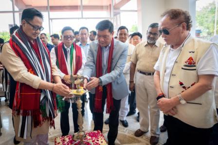 Khandu inaugurates Arunachal Niwas, fourth facility in New Delhi
-
ACS announces sit-in protest, demands CM’s resignation on moral grounds
-
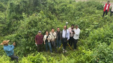 Assam-Arunachal border delineation exercise concludes in Lower Siang
-
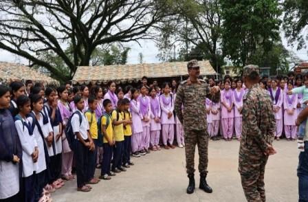 Indian Army commemorates first anniversary of Operation Sindoor
-
Fun, creativity mark VKV Alumni Summer Camp at Chimpu school
-
Power lines severely damaged in Khonsa
-
KV Khonsa shines at KVS Tinsukia Regional Sports Meet
-
 Khandu calls Arunachal “powerhouse of India” in hydropower generation
-
Itanagar Police arrests key interstate heroin supplier
-
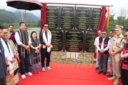 Mein inaugurates key infra projects under PMGSY-III
ITANAGAR, Nov 11: A one day orientation training on ‘Satellite Based Monitoring & Geotagging for District Health officials’ was organised today by National Health Mission (NHM) in collaboration with the Department of Planning & Investment and State Remote Sensing Application Centre here at NHM Training Hall.
The training was attended by the DRCHOs and DPMs of the districts. Director (Monitoring) Department of Planning & Investment, Mokir Ori informed that all government schemes shall come under one portal and planning department would provide one-stop solution to all work departments for their smooth execution and monitoring. After geotagging of all schemes and projects, they will be entered into MIS which will then be automatically transmitted to the SRSAC portal, he added. Trainers imparted hands-on training on geotagging and development projects and explained about mobile application and web portal dashboard. Resource Person in his Power Point Presentation highlighted the benefits of geotagging and said it will bring transparency, better accountability, check corruption and end duplicity of any project.
Meanwhile, Jt. Director Family Welfare Dr Saibal Bhattacharjee advised the participants to take the training seriously and implement the methods in their respective districts. Earlier, Dr Raja Dodum explained the benefits of geotagging while implementing NHM programmes.

Kenter Joya Riba
(Managing Editor)She is a graduate in Science with post graduation in Sociology from University of Pune. She has been in the media industry for nearly a decade. Before turning to print business, she has been associated with radio and television.
Email: kenterjoyaz@easternsentinel.in / editoreasternsentinel@gmail.com
Phone: 0360-2212313